It’s one thing to bump into another hunter back in the timber and realize you’re both working the same ridge. It’s another thing entirely to walk onto your own family’s ground in rifle season and find a stranger settled in with a feeder and a freestanding blind—then have him look you in the eye and say it’s his place, and he’s not going anywhere.
That’s the situation a Canadian hunter’s girlfriend laid out in the original post, explaining she was writing on behalf of her boyfriend, the titled owner of a 50-acre parcel his father bought about 20 years ago and transferred to him roughly 10 years back. The land sits a few properties away from their main camp, and it hasn’t been hunted heavily in recent years—until changing access forced them to lean on their own acreage again.
A quiet 50 acres suddenly wasn’t quiet anymore
Like a lot of big-woods properties, this one isn’t the kind you drive around and admire from the road. They reach it by crossing other land they have permission to use, and the boundaries aren’t marked with nice clean fence lines and corner posts you can spot from 200 yards out.
So they did what plenty of hunters and landowners do: grabbed GPS and GIS mapping to get a workable idea of where lines should be, understanding that digital mapping can be off. They even hung a few pieces of flagging tape—basic, harmless markers so they could orient themselves later.
A couple acres in, they hit something they weren’t expecting: a man already set up with a deer feeder and a blind, acting like he belonged there.
The confrontation happened with rifles in the picture
They introduced themselves and told the man the parcel was in the boyfriend’s name. They offered to show him their map and GPS lines. According to the post, the man refused to come down and talk it out, claimed he’d “been here 50 years” (despite appearing to be barely 50 years old), and said he was using the same GIS system and had “checked” that the land was his.
What he didn’t have was a survey, and what he also didn’t seem able—or willing—to do was describe where his property lines actually were. When asked for even a general start/stop so they could figure out whether it was a close-to-the-line misunderstanding, he “seemed to have no idea or didn’t care,” the poster wrote.
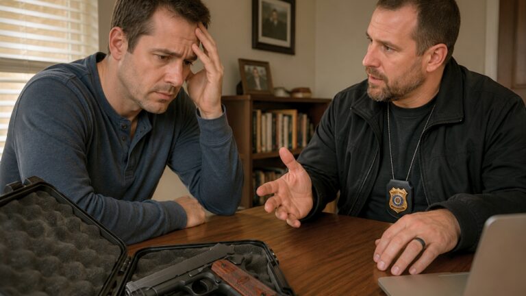
And the detail every hunter will feel in their gut: it was rifle season, and everybody involved had guns. They walked away. That’s not backing down; that’s making the only smart call when you’ve got an unknown person, unknown intentions, and a hot-tempered property dispute happening in the middle of the woods.
The paperwork at the county office didn’t match the stranger’s story
After the run-in, the poster went to the county office to verify the ownership on record and compare what she had on her maps to what the county showed. The county’s information matched her map “exactly,” she said, and the deed for the land they were standing on was under her boyfriend’s name.
In other words, this wasn’t a case of “we think it’s ours” based on an app screenshot. They had the deed, and the county records lined up with where they’d been. From their perspective, the stranger was not just confused—he was dug in.
The scary part is how common that mindset can be on rural ground. A guy hunts a piece for years because nobody stops him. Maybe he’s riding old directions, old handshake access, or a boundary line myth that got passed around campfires. Then one day the real owner shows up, and instead of a conversation, you get a refusal.
Digital maps are useful—until they’re not
The poster was upfront about what a lot of us already know: GIS data can be off, sometimes by a lot. In deep woods with swamps, water borders, and no visible pins or stakes, that margin of error can turn into a real problem fast.
That’s why “get a survey” always gets tossed out as the clean answer. But it’s also why landowners groan when they hear it. Paying for a survey on a remote, inaccessible parcel—especially one with wet borders—can get expensive in a hurry, and you might not get a crew out there quickly during the busiest part of the season.
Still, the other side of that coin is just as real: if a trespasser is bold enough to put up equipment, feed deer, and tell the owner he’s staying, you’re already in “prove it and document it” territory. A phone app and a hunch won’t remove a guy who’s decided reality is optional.
Hunters honed in on two things: safety and documentation
Even without seeing a full comment section in the pasted material, the big pressure points are obvious. First is safety. When you’ve got unknown hunters on ground you plan to hunt, the risk isn’t theoretical. Stands get shot. People get mistaken. A feeder and blind tucked back a couple acres can put someone downrange of where you’d never expect them.
Second is documentation, because documentation is what turns “he said, she said” into something an officer, warden, or court can actually act on. The poster asked whether showing a warden or sheriff the GIS map would be enough to get the man to leave if it came to that. She also asked whether leaving a copy of the map, county info, a letter explaining the situation, and contact info on the blind would be overstepping.
That instinct—do it civilly, do it clearly, and create a paper trail—is solid. The trick is making sure the next step doesn’t put you back into a face-to-face argument with armed strangers during rifle season. Nobody wins that kind of “property line debate.”
The practical options looked limited, and none were free
From the outside looking in, the bind is pretty clear. They don’t want to get into a confrontation. They don’t want to pay a massive bill for a survey. But they also don’t want a stranger planting himself on their parcel with a feeder and blind and acting like that’s normal.
The poster also wondered about the “burden of truth”—why they should have to spend big money to prove the stranger wrong when he’s using “the same map that shows him smack dab” on their land and refuses to even discuss boundaries. That’s a fair frustration, but rural disputes don’t always hinge on what’s fair; they hinge on what’s enforceable and what’s provable.
In the real world, this is where landowners usually start tightening the basics: gather the deed and county printouts, document what’s on the ground (photos of the blind and feeder, dates and times), and make the right calls to the right local authorities for trespass guidance. And if it keeps going, yes, the survey may become the unavoidable expense—because a clean, professional boundary determination is what ends arguments instead of feeding them.
One thing the couple already did right was walking away when the temperature rose. When guns are present, “being right” doesn’t keep you safe. Clear heads and a documented plan do.
At the end of the day, hunting property is supposed to be an escape. But when access changes, boundaries get fuzzy, and somebody decides your ground is now their personal spot, it stops being a getaway and turns into a serious problem. The best move is the one that gets the land back under the owner’s control without anybody getting hurt—and that usually means patience, paperwork, and letting the right professionals draw the hard lines.
Like The Avid Outdoorsman’s content? Be sure to follow us.
Here’s more from us: