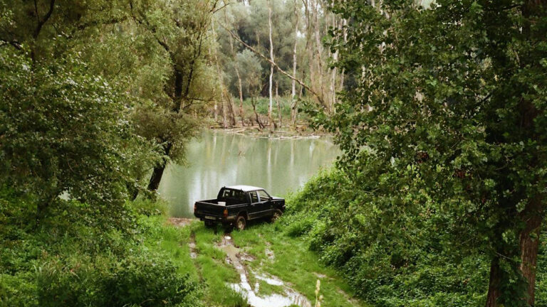
Photo credit: AvidOutdoorsman
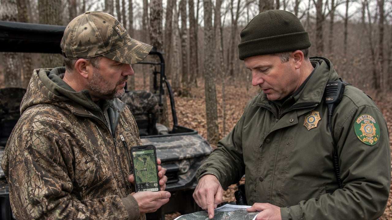
It was one of those crisp Missouri mornings where everything feels right—light wind, damp leaves, and a hunter tucked into cover on a fencerow that had produced deer in years past. He wasn’t out in the wide-open. He wasn’t crowding a farmhouse. He had a GPS app open, a pin dropped, and the comfort that comes with thinking technology has your back.
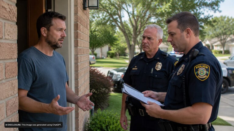
Then the conservation agent walked in.
A small number on a screen turned into a big problem
The setup was simple: the hunter had picked a spot near a property edge and a right-of-way where the rules require a setback. In many places, that setback is there to keep shots pointed away from buildings, roadways, and occupied areas—common sense stuff. The hunter believed he’d done it right, because his phone showed him inside the buffer and clear of the restricted line.
But the agent’s first question wasn’t about deer movement or what the wind was doing. It was about distance. The hunter’s GPS said he was legal. The agent’s map said he was not—by about 40 yards.
Setbacks aren’t just “property line” issues
A lot of hunters hear “setback” and think it’s the same as “don’t trespass.” It isn’t. Trespassing is about being where you don’t have permission to be. Setbacks are often tied to safety zones, public rights-of-way, residences, barns, and sometimes parks or managed areas with extra rules.
That’s why these cases get touchy fast. A person can be standing on land they have permission to hunt, still be in violation, and not even realize it until somebody measures it the way the regulation defines it.
The phone was “close,” but the official record wasn’t the phone
This is where it got interesting. The hunter tried to do what most of us would do: he showed the app. He zoomed in, showed the layers, pointed to the waypoint, and even pulled up his track log to prove he hadn’t been creeping toward the line.
The agent wasn’t rude, but he wasn’t budging either. The app wasn’t the controlling document. The printed map—one the agency uses for enforcement and boundary determinations—was. According to that map, the setback boundary wasn’t where the phone suggested it was. It was farther back, and the hunter’s position was on the wrong side of it.
If you’ve ever watched two GPS units disagree by 30 feet while you’re standing still, you know how this happens. Add in aerial imagery that’s a couple years old, shapefile boundaries that don’t match the ground perfectly, and phone GPS accuracy that can swing depending on canopy cover, and you’ve got a recipe for a “close enough” situation turning into a citation.
How 40 yards disappears in the real world
Forty yards doesn’t sound like much until you’re trying to judge it without a tape. In thick timber, it’s a couple of big trees and a patch of brush. Along a creek, it might be one bend. In a cut cornfield, it looks like nothing.
Most mapping apps also give people a false sense of precision. The pin looks exact. The boundary line looks crisp. But those lines are often approximations laid over imagery. If the underlying boundary is off, your “exact” pin is just exactly wrong.
Then there’s the accuracy banner many folks ignore. When your phone says accuracy is 15–30 feet, that’s best-case under decent conditions. In a hollow or under heavy canopy, it can drift worse. That drift doesn’t always show as a big warning—your blue dot just slides, and you don’t notice because you’re focused on the woods, not the screen.
What the hunter could do in that moment (and what he couldn’t)
When an agent says the agency’s printed map is the official record, arguing on the side of the trail rarely helps. You can be right in spirit and still lose on paper. The hunter’s best move was to cooperate, keep his hands visible, and avoid making the contact feel like a standoff.
Practically, there were only a few options in that moment: move immediately to a clearly safe and legal location, ask the agent to show the map boundary and the reference points used to measure, and document the location for later—calmly. Not by filming in someone’s face. Just by noting coordinates, taking a picture of the general area, and asking what process exists to dispute the boundary if the hunter believes the map is wrong.
What he couldn’t do was “prove” legality with a consumer app as if it overrides agency mapping. In most states, enforcement relies on the agency’s official layers, legal descriptions, and published materials. Your app is a tool, not a court record.
Commenters zeroed in on apps, survey stakes, and “paper vs. pixels”
Outdoorsmen love technology right up until it bites them. The discussion around situations like this usually splits into two camps: the folks who say “you should’ve known better than to trust a phone,” and the folks who say “if the public is expected to follow rules, the boundaries should match what the public can access.”
Some hunters pointed out the obvious: if a setback matters, you build in a cushion. Don’t cut it close. If the rule says a certain distance, give it extra. Hunt 100 yards farther back than you think you need to. That’s easy to say until the only good tree and the only good wind put you near the edge, but it’s still sound advice.
Others brought up survey markers and property corners. That’s a good instinct, but it doesn’t solve every setback issue because a setback might be measured from a structure, a road edge, a designated boundary, or a management line—not always a surveyed property corner. And plenty of corners in rural areas are buried, bent, or “known” more by tradition than by a stake you can actually find.
A few folks also emphasized printing the agency map ahead of time, or at least saving the agency’s own PDF or official web map layer to your phone. That’s one of the better middle-ground solutions: if you’re going to rely on a map, rely on the same one the agent is going to reference.
The real lesson: don’t hunt the line when the line can move
This kind of run-in doesn’t mean conservation agents are out looking to jam up honest hunters. It usually means the rule is written in a way that requires a defined reference, and the agency has chosen its official reference. That’s what they’re going to enforce, even if your screen shows something else.
If you hunt places with safety zones, right-of-way buffers, refuge borders, or special area setbacks, treat the boundary like a hot stove. Give it room. Carry a rangefinder and use it to add margin, not to cut it close. If you’re setting a stand or blind, pick a spot that stays legal even if the GPS drifts and even if the boundary line isn’t perfect.
Technology is still worth using. It keeps people from getting turned around, helps recover game, and prevents a lot of trespass problems. But when it comes to setbacks and enforcement, the safe play is old-school: know the rule, use the official map, and leave yourself extra space so 40 yards can’t ruin your season.
Like The Avid Outdoorsman’s content? Be sure to follow us.
Here’s more from us: